
Ogden Neighbors by Block Source
Neighbor records answer different questions. Geo-Gizmo helps locate adjacent parcels. Parcel Search supplies indexed ownership and tax-address data. Utah voter records can show standard fields when a lawful request qualifies, but protected voters are withheld. Community groups and historical directories add local context without publishing a citywide member list.
| Source | What It Shows About a Block | Access |
|---|---|---|
| Weber GIS / Geo-Gizmo | Adjacent parcel polygons and map context | Free interactive viewer |
| Weber Parcel Search | Owner, property and mailing address, legal description | Free online |
| Weber voter request | Standard registration and vote-history fields, if releasable | Form, fee, use affirmation |
| Ogden civic layer | Districts, OgdenCAN, Neighbor Up, public meetings | Public pages |
| Directories and newspapers | Past block households and local events | Library / digital collections |
An owner record is not an occupant record. A different mailing address may reflect a trust, estate, or administrative choice. A voter match is a registration connection at a point in time, not proof that every household member lives there. Read each source for what it says and no more.
Block research is strongest when the unit of comparison is explicit. A parcel is a legal land unit, a street segment is a set of addresses, and a neighborhood label is a civic or informal geography. One block may contain several subdivisions, a corner parcel with a different postal city, or a public facility that has no household at all. Define the target address and the surrounding distance before counting adjacent records.
Geo-Gizmo for Ogden Neighbors
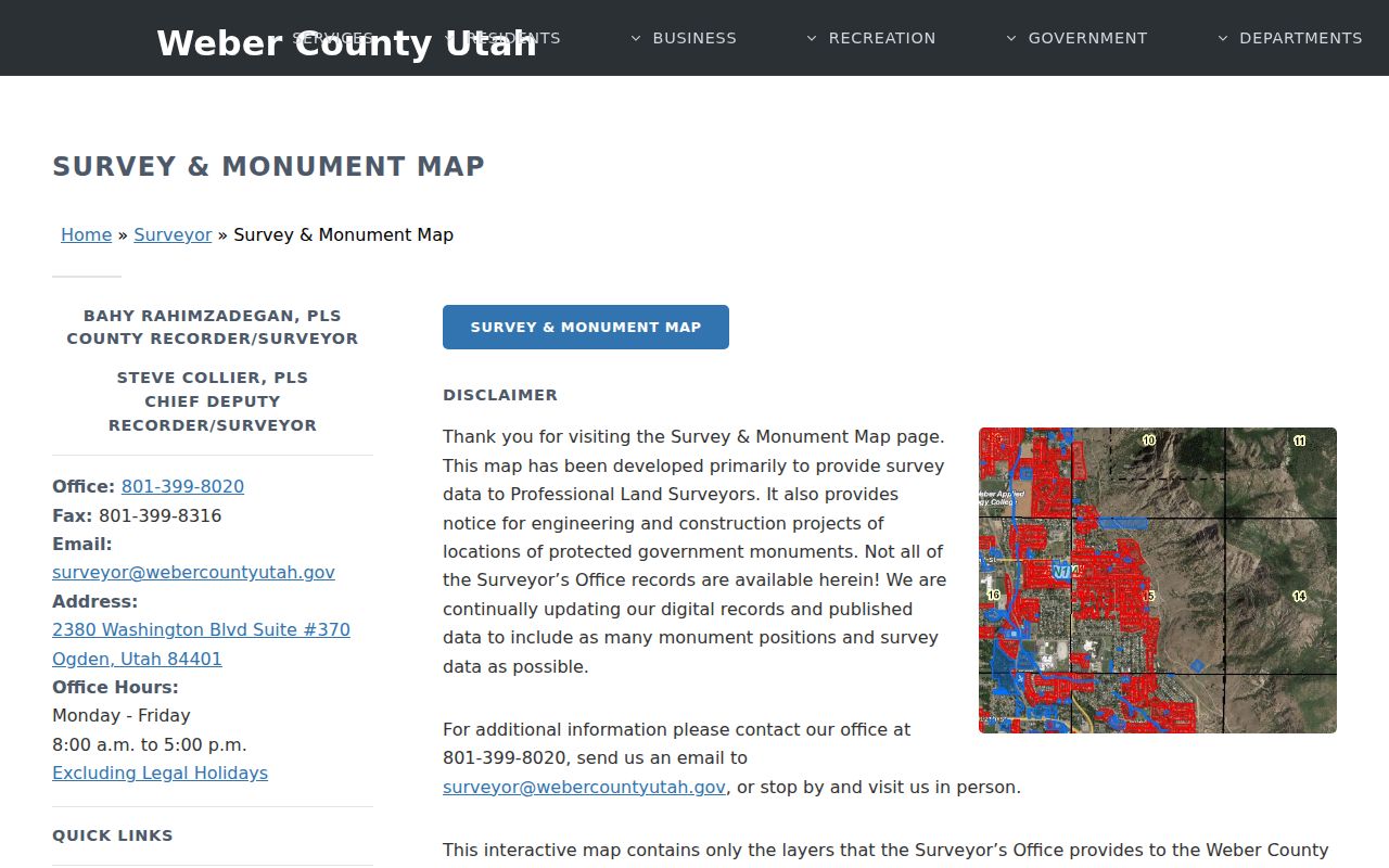
Weber County’s Surveyor Interactive page links to Geo-Gizmo and explains the map’s limits. Tax parcel lines are visual representations based on recorded legal descriptions, not exact ground boundaries. The viewer can provide parcel context, survey and monument layers, and a click path into an owner or parcel result when configured. It is free to browse.
For neighbors, locate the target address, click the polygon, and pan outward. Note the parcel number, then repeat in Parcel Search. If two polygons look joined or a line seems off, return to the legal description or recorded survey. A map is excellent for finding the next record; it is not a survey.
Write down the map date and the layers used. A viewer may update parcel boundaries, imagery, or labels without preserving the same display. The parcel number is the durable handoff to the county record, while the map screenshot only documents what was visible at that time. Avoid treating a drawn line as evidence of who occupies either side of it.
Ogden Neighbors and City Lines
Nearby addresses can sit in South Ogden, Washington Terrace, Riverdale, West Haven, North Ogden, or unincorporated Weber County even when a postal label looks like Ogden. Ogden’s municipal district map accepts an address and returns an elected district, but that result is not an occupant record. City GIS and county GIS answer different boundary questions.
Check the city or county line before requesting permits, code cases, or municipal records. The county Parcel Search remains useful for land in Weber County, while the city office holds its own building and code routes. This small jurisdiction check prevents a block lookup from sending a request to the wrong custodian.
Postal geography adds another source of confusion. Ogden routing can reach nearby South Ogden, Washington Terrace, Riverdale, West Haven, North Ogden, and unincorporated Weber County. Compare the postal city with the municipal district result and the parcel’s property address. If those fields disagree, preserve the disagreement and ask the relevant custodian which jurisdiction owns the requested record.
Ogden Neighbors, OgdenCAN, and Neighbor Up
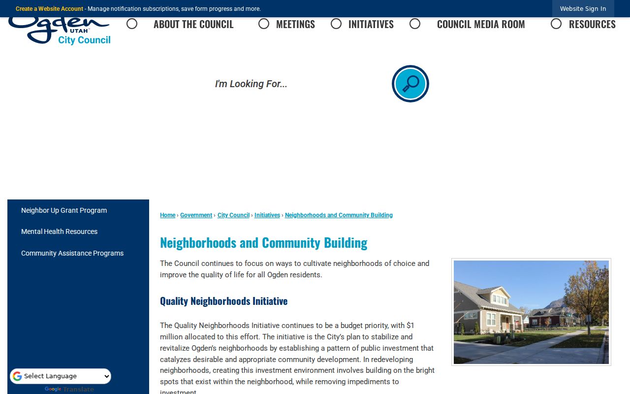
Ogden’s community-building pages document OgdenCAN, Neighbor Up grants, neighborhood watch and report-a-concern channels, district maps, public meetings, and a community resource guide. These are ways to understand civic activity around a block. They are not public membership directories, and the city does not publish one official member-by-member neighborhood association list in the researched sources.
Private associations may record declarations, covenants, conditions, and restrictions with the Recorder. Those recorded documents can identify an organization or subdivision, but they do not expose a current roster of people. For a community question, use the public contact or meeting route and ask only for an existing record.
Block-Level Voter Data for Ogden Neighbors
Utah voter records have a public and private split. The Weber request form can include voter name and ID, address, registration date, precinct, districts, political party, age, and vote history. It lets a requester choose the entire county, a municipality, school-board district, state legislative district, or another defined scope. The form requires a use affirmation and says not to share data with someone who is not entitled to it.
The county lists scornell@webercountyutah.gov and 801-399-8034, says fees are calculated under Utah Code §63G-2-203(10), and allows email delivery after processing. At-risk or private voters are withheld. Vote history can show participation, method, and date, not how a person voted. Use this source only for a lawful, defined request.
Safe at Home and Ogden Neighbors
Utah Safe at Home serves qualifying survivors of abuse, child abuse, domestic violence, stalking, sexual assault, or human trafficking who fear physical danger and meet the program’s residency, documentation, and application rules. It supplies a substitute state-office address and mail forwarding at no cost, with four-year certification and renewals. State and local agencies must accept the substitute address.
The actual home and mailing address, city and county, precinct, phone, and other identifying location details can be confidential. Participation and a substitute address are not the same as a public household result. A block map should never be used to infer where a protected person lives.
Map Ogden Neighbors One Parcel at a Time
Start with the target address in the Weber County GIS viewer. The text research confirms pan, zoom, parcel clicking, identify behavior, and layer toggles, although the current interactive page does not expose a fixed list of every layer or a guaranteed buffer tool. Treat the map as a locator, then verify every adjacent parcel in Parcel Search.
- Locate the address in Weber Geo-Gizmo.
- Click or pan to surrounding polygons and write down each parcel number and legal-description clue.
- Confirm each parcel in Parcel Search, reading owner, property address, mailing address, and tax information.
- Use a voter or community source only for the separate question it can answer.
When the question expands from one block to a whole named street, use the Ogden street directory for the full address chain.
Official Rolls Versus Ogden Neighbor Tools
Official Ogden and Weber records have a named custodian, a stated field set, and a correction path. Commercial neighbor tools combine public, purchased, and marketing data with unknown update cycles. They can be useful as a lead only when the source record is checked directly. They cannot open a protected record or make a stale address current.
| County parcel record | Indexed owner, parcel, property and mailing address, legal description, and tax fields; free online, with office and request backups. |
|---|---|
| GIS viewer | Adjacent polygon and map context; reference-only boundaries that need deed or survey confirmation. |
| Voter data | Registration fields under Utah access rules; private and at-risk records withheld. |
| Commercial category | Aggregated leads with variable accuracy, cost, update timing, and opt-out practices. |
For a block question, official records are slower but accountable. Keep the parcel number and source date, and contact the custodian when a result is wrong.
Commercial tools can also combine people who share a surname, recycle an old address, or present an association without showing the underlying document. Use such a result only as a prompt for a named official source. A direct parcel record, released voter field, city record, directory page, or newspaper item should carry the factual claim. If no primary source supports the lead, leave it unresolved.
Privacy Limits for Ogden Neighbors
Public parcel data does not list renters, household members, utility customers, or delivery recipients. Utah’s voter system withholds private and at-risk records. Utah Safe at Home provides a substitute address and mail forwarding for qualifying survivors, while the actual home address and related identifying details can remain confidential. A missing result may reflect a legal boundary, not an empty home.
Lawful use. Neighbor records are for getting to know the block, reconnecting, and ordinary personal safety awareness. Do not use an Ogden neighbor lookup to monitor, harass, or intimidate anyone; Utah Code §76-5-106.5 addresses stalking conduct.
A missing name is not evidence that a home is vacant, and a parcel owner is not necessarily a household member. Private and at-risk voter records, substitute-address participants, and nonpublic household details should remain outside a block list. The responsible endpoint is a general civic, records, or safety resource, not an attempt to identify a protected person.